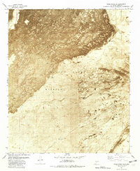
1981 Map of Three Rivers SW
USGS Topo · Published 1981About this map
The Malpais dominates the upper half of this orthophotomap, showing the dark, textured expanse of an ancient volcanic field. Produced from aerial photography taken in the early 1970s, the map provides a rare visual record of the stark transition between these Lava flows and the surrounding desert floor within Otero County. Much of the southern landscape is defined by the restricted boundaries of the White Sands Missile Range, an area where human presence is primarily marked by essential water resources for ranching or military use. Small, isolated catchments like Lower Steer Pasture Tank, Long Tank, and Road Tank are the primary landmarks in this arid environment, revealing the critical infrastructure required to manage such a remote section of New Mexico during the late twentieth century.
Find a feature on this map
8 named features on this map. Tap any name to fly to it.
Don’t see what you’re looking for? This feature index may not catch every label — zoom into the map to look around manually.
Map Details
Editions of this 1981 Three Rivers SW Map
This is the sole edition of this map. No revisions or reprints were ever made.
Other maps of this area

1916 · Tularosa
USGS Topo · 1:125,000

1947 · Three Rivers
USGS Topo · 1:62,500

1947 · Capitol Peak
USGS Topo · 1:62,500

1948 · Lumley Lake
USGS Topo · 1:62,500

1948 · Tularosa
USGS Topo · 1:62,500

1950 · Three Rivers
USGS Topo · 1:24,000

1950 · Oscura
USGS Topo · 1:24,000

1954 · Tularosa
USGS Topo · 1:250,000

1958 · Tularosa
USGS Topo · 1:250,000

1981 · Tularosa
USGS Topo · 1:100,000