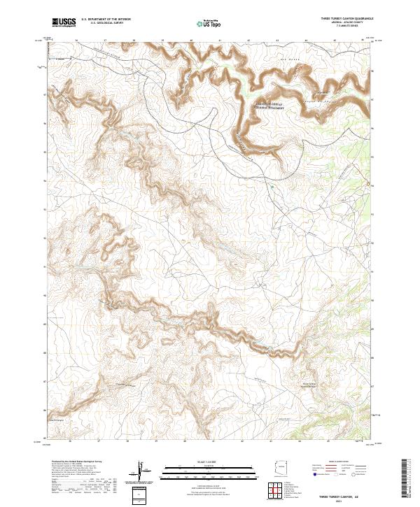
2021 Map of Three Turkey Canyon
USGS Topo · Published 2021About this map
Canyon de Chelly National Monument defines the northern reaches of this high desert landscape, where deep sandstone drainages like Spring Canyon and Little White House Canyon carve into the Defiance Plateau. The terrain is characterized by intricate wash systems, notably Tiis Ndiitsooi Wash and Tse Deeshzhaai Wash, which trend southwestward through Navajo Nation lands. This modern survey illustrates the complex natural topography of the region, anchored by landmark formations such as Ata Deeza and The Window. Significant access is provided by Indian Route 7/NPS 10/S Rim Dr, which skirts the rim of the canyon system. To the south, the namesake Three Turkey Canyon leads toward the Three Turkey Natural Bridge, a prominent geological feature situated among the high ridges. The map meticulously records the intersection of modern tribal routes like Indian Rte 8018 and historical land-survey markers across several townships.
Find a feature on this map
27 named features on this map. Tap any name to fly to it.
Don’t see what you’re looking for? This feature index may not catch every label — zoom into the map to look around manually.
Map Details
Editions of this 2021 Three Turkey Canyon Map
This is the sole edition of this map. No revisions or reprints were ever made.
Other maps of this area

1886 · Fort Defiance
USGS Topo · 1:250,000

1892 · Fort Defiance
USGS Topo · 1:250,000

1892 · Canyon De Chelly
USGS Topo · 1:250,000

1954 · Shiprock
USGS Topo · 1:250,000

1954 · Gallup
USGS Topo · 1:250,000

1955 · Chinle 4 NE
USGS Topo · 1:24,000

1955 · Zith-Tusayan Butte 2 NW
USGS Topo · 1:24,000

1955 · Chinle 4 SE
USGS Topo · 1:24,000

1955 · Zith-Tusayan Butte 2 NE
USGS Topo · 1:24,000

1955 · Sonsala Butte 3 SE
USGS Topo · 1:24,000