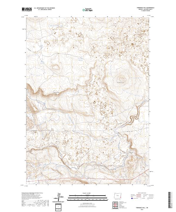
2023 Map of Threemile Hill
USGS Topo · Published 2023About this map
Jordan Creek meanders across this corner of Malheur County, carving a path through an arid landscape defined by managed water and volcanic terrain. The intricate network of the North Side Canal and South Side Canal illustrates the intensive water management required in this region, feeding into various catchments like Saddle Butte Reservoir and the Hidden Reservoir. Elevation is marked by the prominent Threemile Hill and the escarpment of Merrill Springs Rim, while the presence of the Lequerica Trap suggests historical livestock management in the high desert. Historically significant routes such as the Old Ion Hwy and Lava Beds Rd provide the primary access through this sparsely populated territory, linking the remote cattle country and canyonlands of eastern Oregon.
Find a feature on this map
21 named features on this map. Tap any name to fly to it.
Don’t see what you’re looking for? This feature index may not catch every label — zoom into the map to look around manually.
Map Details
Editions of this 2023 Threemile Hill Map
This is the sole edition of this map. No revisions or reprints were ever made.
Other maps of this area

1955 · Jordan Valley
USGS Topo · 1:250,000

1955 · Boise
USGS Topo · 1:250,000

1957 · Jordan Valley
USGS Topo · 1:250,000

1958 · Boise
USGS Topo · 1:250,000

1958 · Jordan Valley
USGS Topo · 1:250,000

1962 · Boise
USGS Topo · 1:250,000
1969 · Little Grassy Mountain
USGS Topo · 1:24,000

1969 · Jordan Craters South
USGS Topo · 1:24,000

1969 · Cow Lakes
USGS Topo · 1:24,000
1969 · Threemile Hill
USGS Topo · 1:24,000