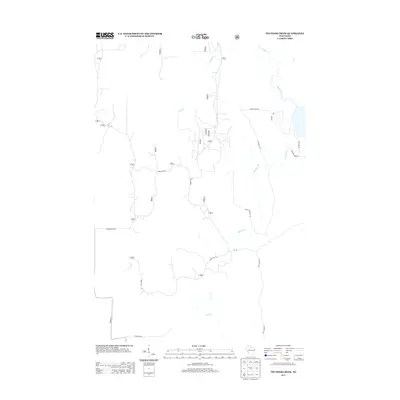
2013 Map of Thunder Creek
USGS Topo · Published 2013About this map
The Willow River and its network of tributaries dominate this forested landscape in Oneida County, defining a region where water and timber access have historically dictated the human footprint. This 2013 survey reveals an intricate system of forestry and access roads, including Forest Rd 130 and Forest Rd 501, which navigate the terrain around Stony Cr and Thunder Cr. The map shows a clear distinction between the larger waterways and the smaller feeder streams like Little Willow Cr and Scott Cr. Locally named thoroughfares such as Dave Wrights Rd, Otto Bez Rd, and Wilson Rd suggest long-standing family ties and property boundaries within this rural corridor. The density of service roads and connectors like N Turcott Rd reflects the modern management of these northern woods for both recreation and industry.
Find a feature on this map
31 named features on this map. Tap any name to fly to it.
Don’t see what you’re looking for? This feature index may not catch every label — zoom into the map to look around manually.
Map Details
Editions of this 2013 Thunder Creek Map
This is the sole edition of this map. No revisions or reprints were ever made.
Other maps of this area

1938 · Lac Du Flambeau
USGS Topo · 1:48,000

1939 · Lac Du Flambeau
USGS Topo · 1:48,000

1939 · Mc Cord
USGS Topo · 1:48,000

1941 · Pike Lake
USGS Topo · 1:48,000

1941 · Brantwood
USGS Topo · 1:48,000

1942 · Pike Lake
USGS Topo · 1:48,000

1943 · Brantwood
USGS Topo · 1:48,000

1946 · Lac Du Flambeau
USGS Topo · 1:48,000

1947 · Mc Cord
USGS Topo · 1:48,000

1950 · Pike Lake
USGS Topo · 1:48,000