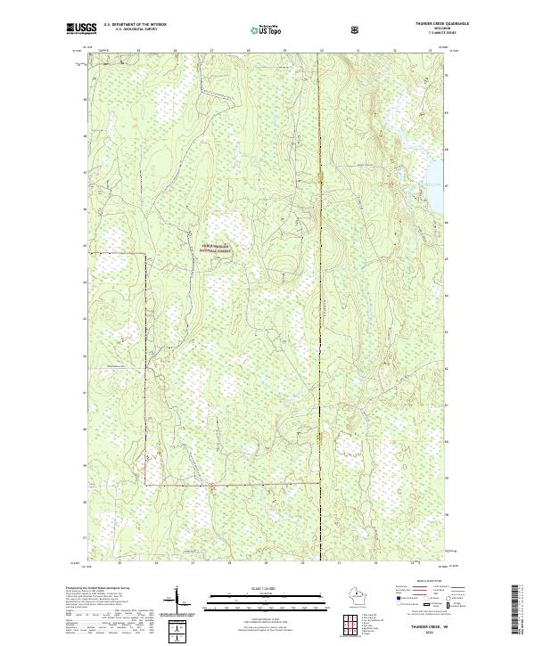
2022 Map of Thunder Creek
USGS Topo · Published 2022About this map
Chequamegon National Forest encompasses the vast majority of this landscape on the boundary of Price and Oneida counties. The terrain is defined by an extensive network of wetlands and small watercourses, most notably the meandering Thunder Cr which flows toward the eastern margin. Human activity is largely seasonal and recreational, evidenced by the Price Co Snowmobile-120a Trl cutting through the northern sections of the forest. In the northeast corner, Willow Lake serves as a primary geographic anchor, surrounded by a cluster of local routes including Wilson Rd and Webster Rd. The map also traces several forestry and county roads like Straveler Rd and Co Rd D that provide access into the densely wooded interior of the Northwoods, where the land remains largely undeveloped and dedicated to timber and conservation.
Find a feature on this map
22 named features on this map. Tap any name to fly to it.
Don’t see what you’re looking for? This feature index may not catch every label — zoom into the map to look around manually.
Map Details
Editions of this 2022 Thunder Creek Map
This is the sole edition of this map. No revisions or reprints were ever made.
Other maps of this area

1938 · Lac Du Flambeau
USGS Topo · 1:48,000

1939 · Lac Du Flambeau
USGS Topo · 1:48,000

1939 · Mc Cord
USGS Topo · 1:48,000

1941 · Pike Lake
USGS Topo · 1:48,000

1941 · Brantwood
USGS Topo · 1:48,000

1942 · Pike Lake
USGS Topo · 1:48,000

1943 · Brantwood
USGS Topo · 1:48,000

1946 · Lac Du Flambeau
USGS Topo · 1:48,000

1947 · Mc Cord
USGS Topo · 1:48,000

1950 · Pike Lake
USGS Topo · 1:48,000