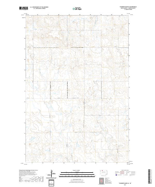
2021 Map of Thunder Hawk SE
USGS Topo · Published 2021About this map
Willow Cr meanders through this portion of Corson County, shaping the drainage patterns across a landscape defined by the Public Land Survey System. The map documents a sparsely populated rural section of South Dakota where the intersection of t22n r18e and neighboring townships dictates the road grid. This 2021 survey reveals a network of section-line roads and local connectors that facilitate travel between remote ranchlands. Critical transit corridors such as Morristown Rd and Keldron Rd link the area to nearby communities, while a series of numbered routes like 107th St and 214th Ave provide the primary infrastructure for land management. The terrain is characterized by subtle elevation changes and coulees, typical of the plains environment south of the North Dakota border.
Find a feature on this map
18 named features on this map. Tap any name to fly to it.
Don’t see what you’re looking for? This feature index may not catch every label — zoom into the map to look around manually.
Map Details
Editions of this 2021 Thunder Hawk SE Map
This is the sole edition of this map. No revisions or reprints were ever made.
Other maps of this area

1953 · McIntosh
USGS Topo · 1:250,000

1956 · Cottonwood Creek NW
USGS Topo · 1:24,000

1958 · McIntosh
USGS Topo · 1:250,000

1972 · Morristown
USGS Topo · 1:24,000

1972 · Black Horse Butte NW
USGS Topo · 1:24,000

1972 · Skull Butte
USGS Topo · 1:24,000

1972 · Thunder Hawk SW
USGS Topo · 1:24,000

1972 · Thunder Hawk SE
USGS Topo · 1:24,000
1972 · Keldron
USGS Topo · 1:24,000
1972 · Thunder Hawk
USGS Topo · 1:24,000