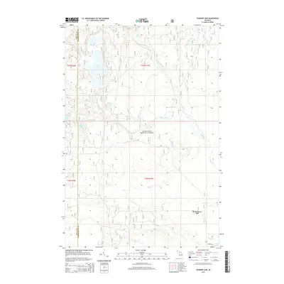
2014 Map of Thunder Lake
USGS Topo · Published 2014About this map
Hiawatha National Forest blankets this corner of the Upper Peninsula, where the border between Delta and Schoolcraft counties bisects a landscape defined by an intricate network of glacial lakes and streams. The largest water bodies, Thunder Lake and Upper Thunder Lake, dominate the northwest quadrant, feeding into a complex drainage system that includes Bear Creek and Carr Creek. These waters eventually contribute to the Indian River, which meanders through the eastern portion of the survey area.
Find a feature on this map
21 named features on this map. Tap any name to fly to it.
Don’t see what you’re looking for? This feature index may not catch every label — zoom into the map to look around manually.
Map Details
Editions of this 2014 Thunder Lake Map
This is the sole edition of this map. No revisions or reprints were ever made.
Other maps of this area

1931 · Cooks NE
USGS Topo · 1:31,680

1931 · Steuben SE
USGS Topo · 1:31,680

1931 · Steuben SW
USGS Topo · 1:31,680

1931 · Steuben NE
USGS Topo · 1:31,680

1931 · Cooks NW
USGS Topo · 1:31,680

1931 · Steuben NW
USGS Topo · 1:31,680

1931 · Skeels Lake NE
USGS Topo · 1:31,680

1932 · Skeels Lake SE
USGS Topo · 1:31,680

1932 · Garden NE
USGS Topo · 1:31,680

1954 · Escanaba
USGS Topo · 1:250,000