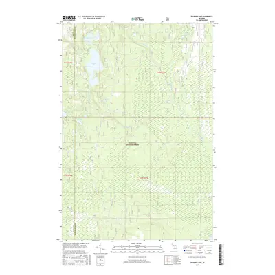
2017 Map of Thunder Lake
USGS Topo · Published 2017About this map
The Hiawatha National Forest dominates this landscape on the Upper Peninsula, straddling the line between Delta and Schoolcraft Counties. This 2017 survey reveals a complex hydrological network defined by the drainage of Thunder Lake and Upper Thunder Lake, which are interconnected by various seasonal and permanent streams. The northern portion of the quadrangle is punctuated by smaller water bodies including Eagle Lake and Frankes Lake, while the southern reaches are marked by the winding courses of the Indian River and Iron Cr. The geography here illustrates the classic glaciated terrain of Michigan's wilderness, where low-lying wetlands and diverse lake systems like Cranberry Lake and Banana Lake shaped the early timber and recreation patterns of the region. Notable landmarks such as Big Spring near the Indian Lake area highlight the unique natural features protected within the national forest boundaries.
Find a feature on this map
22 named features on this map. Tap any name to fly to it.
Don’t see what you’re looking for? This feature index may not catch every label — zoom into the map to look around manually.
Map Details
Editions of this 2017 Thunder Lake Map
This is the sole edition of this map. No revisions or reprints were ever made.
Other maps of this area

1931 · Cooks NE
USGS Topo · 1:31,680

1931 · Steuben SE
USGS Topo · 1:31,680

1931 · Steuben SW
USGS Topo · 1:31,680

1931 · Steuben NE
USGS Topo · 1:31,680

1931 · Cooks NW
USGS Topo · 1:31,680

1931 · Steuben NW
USGS Topo · 1:31,680

1931 · Skeels Lake NE
USGS Topo · 1:31,680

1932 · Skeels Lake SE
USGS Topo · 1:31,680

1932 · Garden NE
USGS Topo · 1:31,680

1954 · Escanaba
USGS Topo · 1:250,000