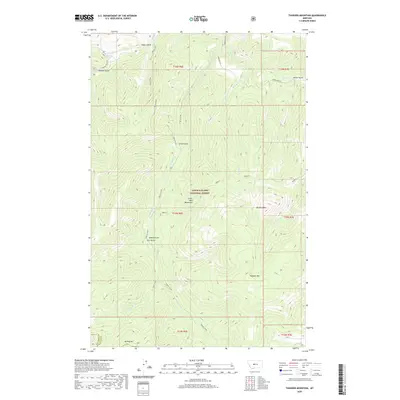
2020 Map of Thunder Mountain
USGS Topo · Published 2020About this map
The Little Belt Mountains dominate this high-altitude section of the Lewis & Clark National Forest, where steep drainages and sharp peaks define the topography. The terrain is characterized by a series of prominent summits including Thunder Mountain, Big Horn Mountain, and Mt Pilgrim at the southern boundary. This area serves as a significant watershed, with numerous named gulches and creeks feeding into larger systems. Waterways like Pilgrim Creek, Belt Creek, and Deer Creek wind through deep cuts in the landscape, reflecting a geological pattern of heavy erosion and established drainage paths. The naming conventions of features like Sawmill Gulch, Goblin Gulch, and Circle Gulch suggest a history of early exploration and resource identification in this part of Cascade and Meagher counties. Human imprint is limited to a few access points such as Logging Creek Road and Jamestown Lane, leaving much of the area in its natural state.
Find a feature on this map
30 named features on this map. Tap any name to fly to it.
Don’t see what you’re looking for? This feature index may not catch every label — zoom into the map to look around manually.
Map Details
Editions of this 2020 Thunder Mountain Map
This is the sole edition of this map. No revisions or reprints were ever made.
Other maps of this area

1886 · Great Falls
USGS Topo · 1:250,000

1886 · Fort Logan
USGS Topo · 1:250,000

1886 · Little Belt Mts.
USGS Topo · 1:250,000

1890 · Fort Benton
USGS Topo · 1:250,000

1892 · Fort Benton
USGS Topo · 1:250,000

1894 · Little Belt Mts.
USGS Topo · 1:250,000

1897 · Fort Benton
USGS Topo · 1:250,000

1897 · Little Belt Mts.
USGS Topo · 1:250,000

1898 · Little Belt Mts.
USGS Topo · 1:250,000

1902 · Little Belt Mts.
USGS Topo · 1:250,000