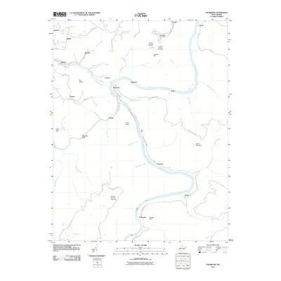
2011 Map of Thurmond
USGS Topo · Published 2011About this map
The New River corridor defines this landscape, where the Chesapeake and Ohio Railway hugs the shoreline through a series of steep mountain gaps. This 2011 survey captures the legacy of the region's industrial past, centered on the historic town of Thurmond, once a primary shipping point for West Virginia coal. The map illustrates a dense concentration of riverside settlements including Sewell, Beury, Claremont, and Thayer, many of which were founded as coal-loading or rail stops along the river bend. Elevated terrain like Garden Ground Mountain and Beury Mountain hem in the narrow valley, while several water control structures such as the Coal Run Number Two Dam and Cedar Branch Dam appear on the tributaries. In the upland areas, the community of Minden and ridges like Pea Ridge contrast with the tight, rail-dominated topography of the lower river canyon.
Find a feature on this map
61 named features on this map. Tap any name to fly to it.
Don’t see what you’re looking for? This feature index may not catch every label — zoom into the map to look around manually.
Map Details
Editions of this 2011 Thurmond Map
This is the sole edition of this map. No revisions or reprints were ever made.
Other maps of this area

1887 · Hinton
USGS Topo · 1:125,000

1889 · Nicholas
USGS Topo · 1:125,000

1891 · Nicholas
USGS Topo · 1:125,000

1891 · Raleigh
USGS Topo · 1:125,000

1892 · Hinton
USGS Topo · 1:125,000

1897 · Kanawha Falls
USGS Topo · 1:125,000

1897 · Raleigh
USGS Topo · 1:125,000

1900 · Kanawha Falls
USGS Topo · 1:125,000

1901 · Nicholas
USGS Topo · 1:125,000

1901 · Kanawha Falls
USGS Topo · 1:125,000