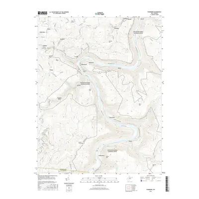
2016 Map of Thurmond
USGS Topo · Published 2016About this map
The New River carves a deep, winding path through the heart of the New River Gorge National River, a landscape defined by sharp elevation changes and riverside settlements. This area, spanning from Oak Hill to the rugged slopes of Beury Mtn, preserves the footprint of a coal and rail-driven economy. At the center of the gorge lies Thurmond, accessible by the Thurmond Bridge and Thurmond St, surrounded by other historic riverside points like Sewell, Beury, and Claremont. High above the river, plateau communities like Minden and Sanger are connected by a network of secondary roads, including Sanger Rd. The map also traces the former industrial and social life of the region through landmarks like the Meadow Fork School and the remote McKendree hospital site, while Gethsemane Memorial Gardens near Pea Ridge serves as a modern touchstone for local genealogy.
Find a feature on this map
109 named features on this map. Tap any name to fly to it.
Don’t see what you’re looking for? This feature index may not catch every label — zoom into the map to look around manually.
Map Details
Editions of this 2016 Thurmond Map
This is the sole edition of this map. No revisions or reprints were ever made.
Other maps of this area

1887 · Hinton
USGS Topo · 1:125,000

1889 · Nicholas
USGS Topo · 1:125,000

1891 · Nicholas
USGS Topo · 1:125,000

1891 · Raleigh
USGS Topo · 1:125,000

1892 · Hinton
USGS Topo · 1:125,000

1897 · Kanawha Falls
USGS Topo · 1:125,000

1897 · Raleigh
USGS Topo · 1:125,000

1900 · Kanawha Falls
USGS Topo · 1:125,000

1901 · Nicholas
USGS Topo · 1:125,000

1901 · Kanawha Falls
USGS Topo · 1:125,000