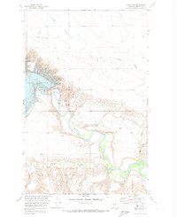
1970 Map of Tiber Dam
USGS Topo · Published 1974About this map
Tiber Dam stands as the central engineering feat of this landscape, holding the waters of the Marias River to create the extensive Tiber Reservoir. Managed by the U.S. Bureau of Reclamation as part of the Missouri River Basin development, the area reflects a mid-century shift toward water management and recreation. The infrastructure supporting the dam is detailed through features like the Spillway 3015, a Pumping Sta, and a Landing Strip, while the Tiber Dam Camp and Sanford Park suggest a small, localized community focused on the site's operation. Beyond the reservoir, the topography is defined by complex drainage patterns including Sixmile Coulee and Crooked Coulee. The presence of several Gravel Pits and the Pugsley Bridge downstream indicates the local importance of road maintenance and river crossings in this Liberty County region.
Find a feature on this map
24 named features on this map. Tap any name to fly to it.
Don’t see what you’re looking for? This feature index may not catch every label — zoom into the map to look around manually.
Map Details
Editions of this 1970 Tiber Dam Map
This is the sole edition of this map. No revisions or reprints were ever made.
Other maps of this area

1954 · Shelby
USGS Topo · 1:250,000

1958 · Shelby
USGS Topo · 1:250,000

1970 · Circle Bridge
USGS Topo · 1:24,000

1970 · Carlson Coulee
USGS Topo · 1:24,000

1970 · Uphill Creek
USGS Topo · 1:24,000

1970 · Sagebrush Coulee
USGS Topo · 1:24,000

1970 · Goose Bill Butte NW
USGS Topo · 1:24,000

1970 · Poverty Coulee
USGS Topo · 1:24,000

1970 · Lothair SW
USGS Topo · 1:24,000
1970 · Lothair
USGS Topo · 1:24,000