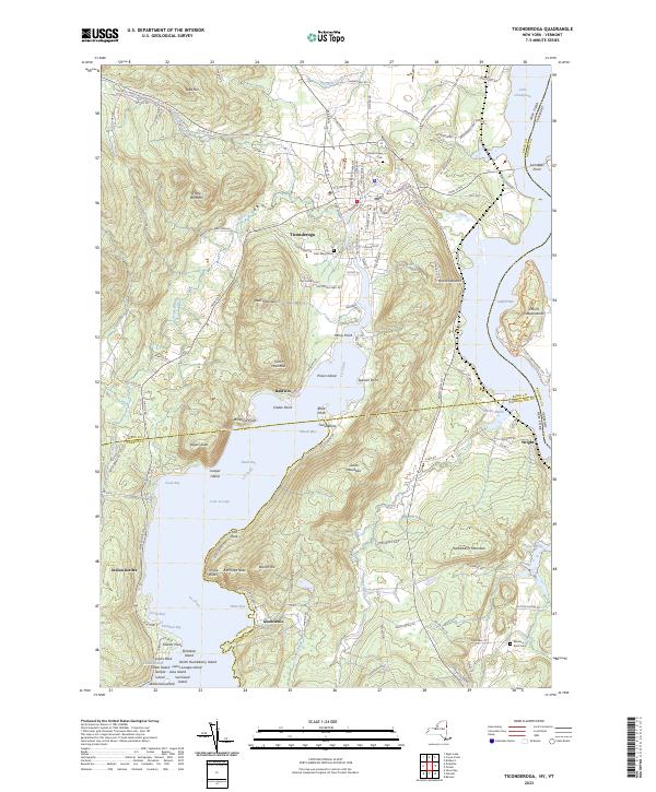
2023 Map of Ticonderoga
USGS Topo · Published 2023About this map
La Chute serves as the narrow hydraulic link between two of the region's major waterways, carving a path from Lake George north toward Lake Champlain. The town of Ticonderoga is positioned at this strategic convergence, surrounded by a complex topography of peaks including Bear Mountain, Cooks Mountain, and Mount Hope. This 2023 survey details the transitional landscape where the Adirondack Park meets the Vermont border, showing a dense network of local roads such as Fort Ti Rd and Montcalm Rd that navigate the ridges and marshes. Genealogists will find the locations of Mount Hope Cem, Saint Marys Cem, and Meadow Knoll Cem clearly marked. The shoreline along the northern reach of Lake George is particularly detailed, identifying landmarks like Rogers Slide, Indian Kettles, and the distinct profile of Anthonys Nose rising above Glenburnie.
Find a feature on this map
132 named features on this map. Tap any name to fly to it.
Don’t see what you’re looking for? This feature index may not catch every label — zoom into the map to look around manually.
Map Details
Editions of this 2023 Ticonderoga Map
This is the sole edition of this map. No revisions or reprints were ever made.
Other maps of this area

1893 · Whitehall
USGS Topo · 1:62,500

1894 · Ticonderoga
USGS Topo · 1:62,500

1895 · Whitehall
USGS Topo · 1:62,500

1895 · Paradox Lake
USGS Topo · 1:62,500

1896 · Ticonderoga
USGS Topo · 1:62,500

1897 · Bolton
USGS Topo · 1:62,500

1897 · Paradox Lake
USGS Topo · 1:62,500

1898 · Whitehall
USGS Topo · 1:62,500

1900 · Bolton
USGS Topo · 1:62,500

1902 · Whitehall
USGS Topo · 1:62,500