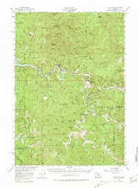
1956 Map of Tidewater
USGS Topo · Published 1981About this map
The Alsea River winds through the heart of the Siuslaw National Forest area in this mid-1950s survey of Lincoln County. The small community of Tidewater serves as a central point along the river, while the settlement of Fisher sits further south near the Lane County line. This terrain is defined by its deep canyons and named ridges, including Fleece Ridge and Sitz Ridge, illustrating a landscape dedicated to timber and forestry. Evidence of local civic life appears at the Yachats Grange and the now-labeled Upper Yachats Sch (Aband).
Find a feature on this map
109 named features on this map. Tap any name to fly to it.
Don’t see what you’re looking for? This feature index may not catch every label — zoom into the map to look around manually.
Map Details
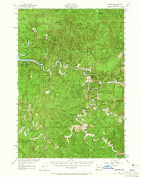
Editions of this 1956 Tidewater Map
3 editions found

Other maps of this area

1918 · Mapleton
USGS Topo · 1:48,000

1920 · Heceta Head
USGS Topo · 1:62,500

1922 · Waldport
USGS Topo · 1:62,500

1939 · Marys Peak
USGS Topo · 1:62,500

1940 · Mapleton
USGS Topo · 1:62,500

1941 · Blachly
USGS Topo · 1:62,500

1942 · Marys Peak
USGS Topo · 1:62,500

1942 · Alsea
USGS Topo · 1:62,500

1942 · Blachly
USGS Topo · 1:62,500

1942 · Waldport
USGS Topo · 1:62,500