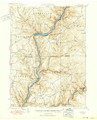
1930 Map of Tidioute
USGS Topo · Published 1950About this map
The Pennsylvania Railroad tracks follow the winding course of the Allegheny River through the heart of Warren and Forest counties, connecting a string of timber and river towns in the early 20th century. This area is characterized by dense forest activity and early industrial infrastructure, evidenced by the extensive Lumber Co Pipe Line and numerous rural schoolhouses such as Triumph Sch and Fleming Hill Sch. The river serves as the primary axis for settlements like Tidioute, West Hickory, and East Hickory, while more isolated communities like Fagundus and Kellettville are tucked into the steep valleys of the surrounding plateau. Local institutions and landmarks, including the County Home and the Wheeler Fire Tower, reveal the social and civic organization of these mountain townships. Genealogists can trace family connections through numerous named churches and burial sites, such as German Hill Ch and Zuendel Ch, which anchored these remote communities.
Find a feature on this map
128 named features on this map. Tap any name to fly to it.
Don’t see what you’re looking for? This feature index may not catch every label — zoom into the map to look around manually.
Map Details
Editions of this 1930 Tidioute Map
4 editions found

Other maps of this area

1906 · Warren
USGS Topo · 1:62,500

1907 · Warren
USGS Topo · 1:62,500

1908 · Warren
USGS Topo · 1:62,500

1918 · Loleta
USGS Topo · 1:62,500

1922 · Oil City
USGS Topo · 1:48,000

1922 · Tionesta
USGS Topo · 1:62,500

1924 · Oil City
USGS Topo · 1:62,500

1924 · Tionesta
USGS Topo · 1:62,500

1926 · Youngsville
USGS Topo · 1:62,500

1927 · Tidioute
USGS Topo · 1:48,000