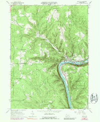
1966 Map of Tidioute
USGS Topo · Published 1989About this map
Tidioute and the surrounding riverfront of Warren Co and Forest Co are documented here during the mid-1960s, a period when the timber and petroleum legacy of the region remained etched into the landscape. The Allegheny River defines the southeastern corridor, flowing past Siggias Island and Courson Island, with several distinct river eddies noted such as Tidioute Eddy and Courson Eddy. The Penn Central rail line follows the river's path, serving as a primary transportation artery through the valley.
Find a feature on this map
42 named features on this map. Tap any name to fly to it.
Don’t see what you’re looking for? This feature index may not catch every label — zoom into the map to look around manually.
Map Details
Editions of this 1966 Tidioute Map
4 editions found
Other maps of this area

1926 · Youngsville
USGS Topo · 1:62,500

1927 · Tidioute
USGS Topo · 1:48,000

1927 · Titusville
USGS Topo · 1:62,500

1929 · Corry
USGS Topo · 1:48,000

1929 · Youngsville
USGS Topo · 1:62,500

1930 · Tidioute
USGS Topo · 1:62,500

1932 · Corry
USGS Topo · 1:62,500

1933 · Titusville
USGS Topo · 1:62,500

1943 · Youngsville
USGS Topo · 1:62,500

1957 · Warren
USGS Topo · 1:250,000