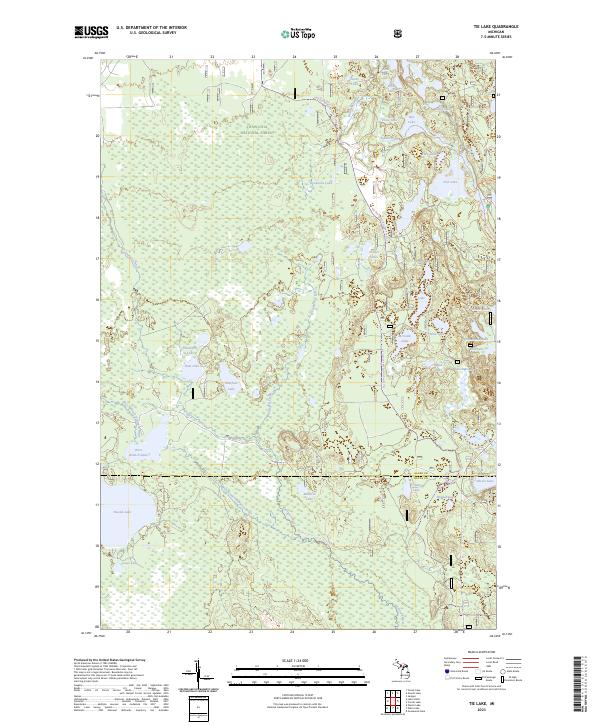
2023 Map of Tie Lake
USGS Topo · Published 2023About this map
The Hiawatha National Forest defines this portion of Michigan’s Upper Peninsula, where the landscape is shaped by an intricate network of glacial lakes and protected waterways. The northern section is dominated by the Indian Wild and Scenic River, which winds near Crow Lake and Bar Lake before flowing through the center of the region. This 2023 survey highlights a primitive wilderness character, with the Big Spring-baldy Lake Snowmobile Trail providing one of the few named terrestrial transport routes through the dense forest.
Find a feature on this map
44 named features on this map. Tap any name to fly to it.
Don’t see what you’re looking for? This feature index may not catch every label — zoom into the map to look around manually.
Map Details
Editions of this 2023 Tie Lake Map
This is the sole edition of this map. No revisions or reprints were ever made.
Other maps of this area

1931 · Skeels Lake NE
USGS Topo · 1:31,680

1931 · Munising SE
USGS Topo · 1:31,680

1932 · Skeels Lake SE
USGS Topo · 1:31,680

1932 · Trenary SE
USGS Topo · 1:31,680

1932 · Skeels Lake NW and SW
USGS Topo · 1:31,680

1958 · Corner Lake
USGS Topo · 1:62,500

1958 · Trenary
USGS Topo · 1:62,500

1958 · Munising
USGS Topo · 1:62,500

1958 · Au Train
USGS Topo · 1:62,500

1958 · Marquette
USGS Topo · 1:250,000