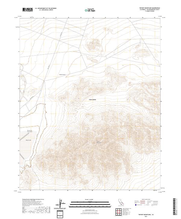
2021 Map of Tiefort Mountains
USGS Topo · Published 2021About this map
Bicycle Lake Army Airfield sits on the western edge of this landscape, positioned alongside the dry expanse of Bicycle Lake. This high-desert terrain is dominated by the steep, rising slopes of the Tiefort Mountains, which occupy much of the southeastern quadrant of the survey. The region is characterized by its military and arid-land utility, with Fort Irwin Rd providing the primary corridor through the northern Mojave Desert flats. The grid of township and range lines, including t15n r4e and t14n r4e, underscores the systematic land management typical of this part of San Bernardino County. These features together illustrate a landscape defined by isolated military infrastructure and dramatic topographic relief in a remote desert environment.
Find a feature on this map
11 named features on this map. Tap any name to fly to it.
Don’t see what you’re looking for? This feature index may not catch every label — zoom into the map to look around manually.
Map Details
Editions of this 2021 Tiefort Mountains Map
This is the sole edition of this map. No revisions or reprints were ever made.
Other maps of this area

1933 · Avawatz Mountains
USGS Topo · 1:250,000

1947 · Trona
USGS Topo · 1:250,000

1948 · Red Pass Lake
USGS Topo · 1:62,500

1948 · Trona
USGS Topo · 1:250,000

1948 · Alvord Mountain
USGS Topo · 1:62,500

1948 · Cave Mountain
USGS Topo · 1:62,500

1948 · Tiefort Mountains
USGS Topo · 1:62,500

1951 · Tiefort Mountains
USGS Topo · 1:62,500

1951 · Cave Mountain
USGS Topo · 1:62,500

1951 · Alvord Mountain
USGS Topo · 1:62,500