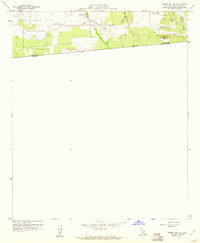
1959 Map of Tierra Del Sol
USGS Topo · Published 1961About this map
The Campo Indian Reservation occupies the western portion of this rugged borderland landscape, where the high desert meets the international boundary between the United States and Mexico. The small settlement of Tierra del Sol serves as a focal point along the tracks of the San Diego and Arizona Eastern railroad, which snakes through the uneven terrain of the southern backcountry.
Find a feature on this map
15 named features on this map. Tap any name to fly to it.
Don’t see what you’re looking for? This feature index may not catch every label — zoom into the map to look around manually.
Map Details
Editions of this 1959 Tierra Del Sol Map
3 editions found
Other maps of this area

1931 · Carrizo
USGS Topo · 1:125,000

1939 · Campo
USGS Topo · 1:62,500

1939 · Jacumba
USGS Topo · 1:62,500

1942 · Campo
USGS Topo · 1:62,500

1942 · Jacumba
USGS Topo · 1:62,500

1950 · San Diego
USGS Topo · 1:250,000

1954 · San Diego
USGS Topo · 1:250,000

1955 · San Diego
USGS Topo · 1:250,000

1958 · San Diego
USGS Topo · 1:250,000
1959 · Campo
USGS Topo · 1:24,000