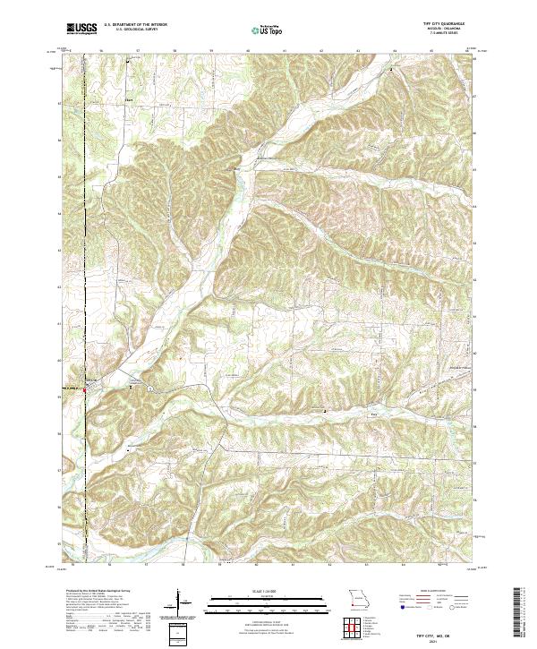
2021 Map of Tiff City
USGS Topo · Published 2021About this map
Tiff City sits at the western edge of the Missouri Ozarks, marking the tri-border interface where McDonald County, Missouri, meets Ottawa County, Oklahoma, and Delaware County, Oklahoma. This landscape is defined by the winding course of the Elk River and a network of deep drainage valleys including Buffalo Creek and Patterson Creek. The settlement pattern follows these creek beds and ridges, with small communities like Hart and Coy connected by a grid of county roads and State Highway B. Family history is deeply rooted in the land here, evidenced by numerous burial sites such as Cummings Chapel Cemetery and the Keenan Cemetery. The terrain is characterized by named hollows and ridges, including Kinslow Hollow and Owens Bluff, reflecting a rural economy and social structure tied to the varied topography of the southwest Missouri borderlands.
Find a feature on this map
87 named features on this map. Tap any name to fly to it.
Don’t see what you’re looking for? This feature index may not catch every label — zoom into the map to look around manually.
Map Details
Editions of this 2021 Tiff City Map
This is the sole edition of this map. No revisions or reprints were ever made.
Other maps of this area

1907 · Wyandotte
USGS Topo · 1:125,000

1909 · Wyandotte
USGS Topo · 1:125,000

1916 · Neosho
USGS Topo · 1:62,500

1940 · Noel
USGS Topo · 1:62,500

1943 · Noel
USGS Topo · 1:62,500

1949 · Seneca
USGS Topo · 1:24,000

1950 · Seneca
USGS Topo · 1:24,000

1954 · Tulsa
USGS Topo · 1:250,000

1958 · Tulsa
USGS Topo · 1:250,000

1961 · Wyandotte
USGS Topo · 1:24,000