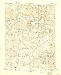
1939 Map of Tiff
USGS Topo · Published 1939About this map
The Big River and its confluence with the Mineral Fork dominate this 1930s landscape, illustrating the transition from rural industrial sites to organized state recreation. The presence of the Thunderbolt CCC Camp within Washington State Park highlights the Depression-era public works that shaped the region during this period. The survey documents a scattered settlement pattern typical of the eastern Ozarks, where small communities like Shibboleth, Bliss, and Mud Town developed around local mining and milling operations.
Find a feature on this map
39 named features on this map. Tap any name to fly to it.
Don’t see what you’re looking for? This feature index may not catch every label — zoom into the map to look around manually.
Map Details
Editions of this 1939 Tiff Map
2 editions found
Other maps of this area

1901 · De Soto
USGS Topo · 1:125,000

1905 · Bonneterre
USGS Topo · 1:62,500

1906 · Potosi
USGS Topo · 1:62,500

1930 · De Soto NE
USGS Topo · 1:24,000

1931 · De Soto SE
USGS Topo · 1:24,000

1937 · Fletcher
USGS Topo · 1:24,000

1937 · Tiff
USGS Topo · 1:24,000

1938 · Fletcher
USGS Topo · 1:24,000

1939 · Tiff
USGS Topo · 1:24,000

1946 · Richwoods
USGS Topo · 1:62,500