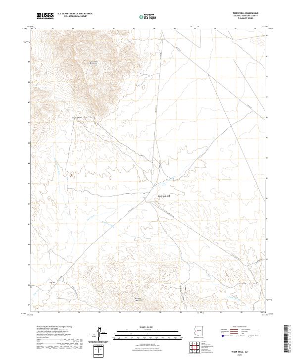
2021 Map of Tiger Well
USGS Topo · Published 2021About this map
Ambrosia Mill and the Tiger Well landmark anchor this desert landscape in western Maricopa County, positioned between two prominent ranges. The terrain is defined by the high elevations of the Harquahala Mountains to the northwest and the Big Horn Mountains to the south. A network of ephemeral drainages, including Browns Canyon Wash, Tiger Wash, and Pump Mine Wash, indicates the complex hydrological patterns that shape the arid floor. The map documents an area deeply tied to its mineral and water resources, with transport routes like Aguila Rd and Eagle Eye Rd connecting the remote industrial sites to the wider region. Much of the activity is concentrated around Browns Canyon, where the topography transitions from the rugged mountain slopes to the alluvial fans below.
Find a feature on this map
21 named features on this map. Tap any name to fly to it.
Don’t see what you’re looking for? This feature index may not catch every label — zoom into the map to look around manually.
Map Details
Editions of this 2021 Tiger Well Map
This is the sole edition of this map. No revisions or reprints were ever made.
Other maps of this area

1942 · Vicksburg
USGS Topo · 1:250,000

1954 · Phoenix
USGS Topo · 1:250,000

1957 · Phoenix
USGS Topo · 1:250,000

1958 · Phoenix
USGS Topo · 1:250,000

1960 · Phoenix
USGS Topo · 1:250,000

1961 · Lone Mountain
USGS Topo · 1:62,500

1961 · Big Horn Mts
USGS Topo · 1:62,500

1961 · Gladden
USGS Topo · 1:62,500
1962 · Aguila
USGS Topo · 1:62,500

1969 · Phoenix
USGS Topo · 1:250,000