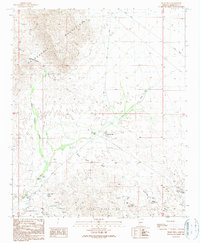
1990 Map of Tiger Well
USGS Topo · Published 1990About this map
Mining and water infrastructure define this arid landscape between the Harquahala Mountains and the Big Horn Mountains in the late twentieth century. The map reveals an intensive history of prospecting and extraction, with operations ranging from Open Pit Mines and Mine Shafts to named sites like the Black Nugget Mine and the Purple Pansy Mine. The central role of the Ambrosia Mill underscores the industrial processing required for the ores pulled from these desert ridges.
Find a feature on this map
28 named features on this map. Tap any name to fly to it.
Don’t see what you’re looking for? This feature index may not catch every label — zoom into the map to look around manually.
Map Details
Editions of this 1990 Tiger Well Map
This is the sole edition of this map. No revisions or reprints were ever made.
Other maps of this area

1942 · Vicksburg
USGS Topo · 1:250,000

1954 · Phoenix
USGS Topo · 1:250,000

1957 · Phoenix
USGS Topo · 1:250,000

1958 · Phoenix
USGS Topo · 1:250,000

1960 · Phoenix
USGS Topo · 1:250,000

1961 · Lone Mountain
USGS Topo · 1:62,500

1961 · Big Horn Mts
USGS Topo · 1:62,500

1961 · Gladden
USGS Topo · 1:62,500
1962 · Aguila
USGS Topo · 1:62,500

1969 · Phoenix
USGS Topo · 1:250,000