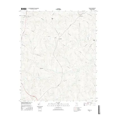
2017 Map of Tignall
USGS Topo · Published 2017About this map
The crossroads community of Tignall serves as the primary hub in this northern Wilkes County landscape, where the local road network fans out toward rural settlements like Sandy Hill and Danburg. The topography is defined by the branching tributaries of Fishing Creek, including the Hog Fork and Morris Creek, which create a complex system of ridges and valleys. Small family and community centers such as Cohentown and Sandtown are connected by historically significant routes like Danburg Road and Sandtown Road. Genealogists will find several notable burial sites documented, including Tignall Cemetery and Danburg Cemetery, as well as the isolated Fishing Creek Cemetery near the creek's upper reaches. The presence of Garrard Lake and Norman Lake in the southern portion of the quadrangle suggests a landscape where water management and agriculture have long shaped the local economy and settlement patterns.
Find a feature on this map
53 named features on this map. Tap any name to fly to it.
Don’t see what you’re looking for? This feature index may not catch every label — zoom into the map to look around manually.
Map Details
Editions of this 2017 Tignall Map
This is the sole edition of this map. No revisions or reprints were ever made.
Other maps of this area

1906 · Crawfordville
USGS Topo · 1:125,000

1953 · Athens
USGS Topo · 1:250,000

1954 · Metasville
USGS Topo · 1:24,000

1955 · Tignall
USGS Topo · 1:24,000

1955 · Broad
USGS Topo · 1:24,000

1955 · Chennault
USGS Topo · 1:24,000

1958 · Athens
USGS Topo · 1:250,000

1959 · Athens
USGS Topo · 1:250,000

1963 · Athens
USGS Topo · 1:250,000
1970 · Jacksons Crossroads
USGS Topo · 1:24,000