
1955 Map of Tignall
USGS Topo · Published 1956About this map
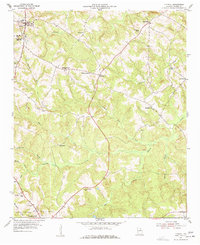
The town of Tignall serves as the primary hub in this mid-century survey of northern Wilkes County, where the landscape is defined by the headwaters of the Fishing Creek system. A remarkable density of educational sites characterizes the area, including Rosenwald High Sch, Danburg Sch, Mulberry Sch, and Cherry Grove Sch, reflecting the distributed nature of rural communities during this era. Small settlements like Sandtown, Morris, and Cohentown are connected by a network of unimproved roads and Georgia Highway 17.
Find a feature on this map
33 named features on this map. Tap any name to fly to it.
Don’t see what you’re looking for? This feature index may not catch every label — zoom into the map to look around manually.
Map Details
Editions of this 1955 Tignall Map
2 editions found
Other maps of this area

1906 · Crawfordville
USGS Topo · 1:125,000

1953 · Athens
USGS Topo · 1:250,000

1954 · Metasville
USGS Topo · 1:24,000

1955 · Broad
USGS Topo · 1:24,000

1955 · Chennault
USGS Topo · 1:24,000

1958 · Athens
USGS Topo · 1:250,000

1959 · Athens
USGS Topo · 1:250,000

1963 · Athens
USGS Topo · 1:250,000
1970 · Jacksons Crossroads
USGS Topo · 1:24,000
1971 · Celeste
USGS Topo · 1:24,000