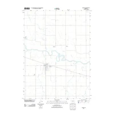
2011 Map of Tilden
USGS Topo · Published 2011About this map
The Elkhorn River meanders across the center of this Nebraska landscape, defining the character of the agrarian region surrounding Tilden. The settlement serves as the local anchor, featuring the Tilden Post Office and a grid of streets including Center St and W 2nd St. This survey captures the rural infrastructure that sustains the area, from the River View Stock Farm to the Tilden East Park Campground along the riverbanks.
Find a feature on this map
31 named features on this map. Tap any name to fly to it.
Don’t see what you’re looking for? This feature index may not catch every label — zoom into the map to look around manually.
Map Details
Editions of this 2011 Tilden Map
This is the sole edition of this map. No revisions or reprints were ever made.
Other maps of this area

1955 · Sioux City
USGS Topo · 1:250,000

1955 · Fremont
USGS Topo · 1:250,000

1957 · Fremont
USGS Topo · 1:250,000

1958 · Sioux City
USGS Topo · 1:250,000

1958 · Fremont
USGS Topo · 1:250,000

1959 · Sioux City
USGS Topo · 1:250,000

1963 · Pierce NW
USGS Topo · 1:24,000
1963 · Oakdale
USGS Topo · 1:24,000

1963 · Emerick
USGS Topo · 1:24,000

1963 · Meadow Grove
USGS Topo · 1:24,000