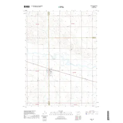
2017 Map of Tilden
USGS Topo · Published 2017About this map
Tilden serves as the central hub of this agricultural landscape, uniquely positioned where Antelope, Pierce, and Madison counties meet. The settlement is defined by its orientation to the Elkhorn River, which meanders through the central portion of the map, and the straight line of Front St that parallels the rail corridor. The surrounding prairie is systematically divided by a grid of rural roads, such as 848th Rd and 840th Rd, reflecting the long-established township and range system.
Find a feature on this map
34 named features on this map. Tap any name to fly to it.
Don’t see what you’re looking for? This feature index may not catch every label — zoom into the map to look around manually.
Map Details
Editions of this 2017 Tilden Map
This is the sole edition of this map. No revisions or reprints were ever made.
Other maps of this area
1955 · Sioux City
USGS Topo · 1:250,000
1955 · Fremont
USGS Topo · 1:250,000
1957 · Fremont
USGS Topo · 1:250,000
1958 · Sioux City
USGS Topo · 1:250,000
1958 · Fremont
USGS Topo · 1:250,000
1959 · Sioux City
USGS Topo · 1:250,000
1963 · Pierce NW
USGS Topo · 1:24,000
1963 · Oakdale
USGS Topo · 1:24,000
1963 · Emerick
USGS Topo · 1:24,000
1963 · Meadow Grove
USGS Topo · 1:24,000