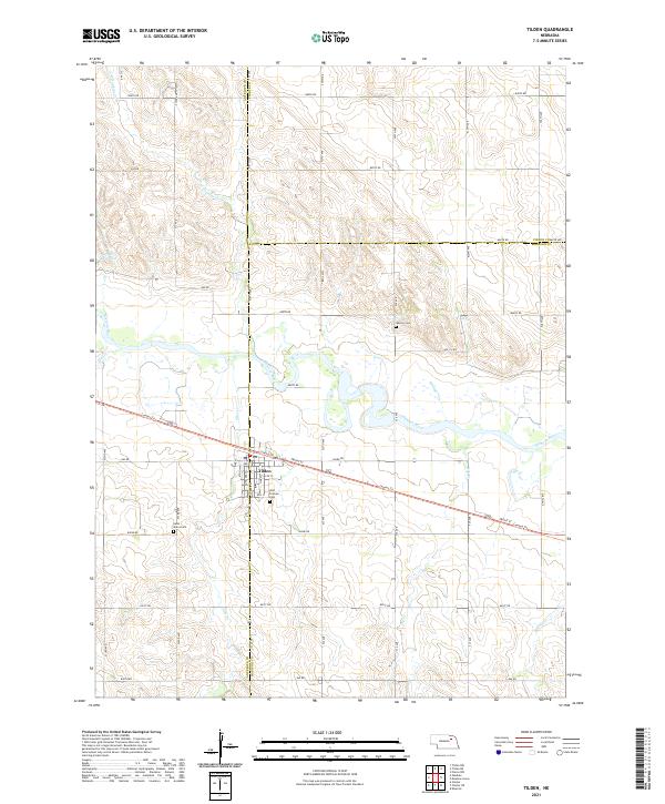
2021 Map of Tilden
USGS Topo · Published 2021About this map
The Elkhorn River winds through the heart of this agricultural region, where the town of Tilden serves as a central hub at the intersection of Antelope and Madison counties. This modern topographic record captures the area's organized road grid and its relationship with the river's riparian corridor. The Cowboy Trl follows a long-established path through the center of town, paralleling Front St and connecting local farms to the settlement. Several smaller tributaries, including Al Hopkins Cr, Giles Cr, and Buffalo Cr, drain into the Elkhorn valley from the surrounding uplands.
Find a feature on this map
35 named features on this map. Tap any name to fly to it.
Don’t see what you’re looking for? This feature index may not catch every label — zoom into the map to look around manually.
Map Details
Editions of this 2021 Tilden Map
This is the sole edition of this map. No revisions or reprints were ever made.
Other maps of this area

1955 · Sioux City
USGS Topo · 1:250,000

1955 · Fremont
USGS Topo · 1:250,000

1957 · Fremont
USGS Topo · 1:250,000

1958 · Sioux City
USGS Topo · 1:250,000

1958 · Fremont
USGS Topo · 1:250,000

1959 · Sioux City
USGS Topo · 1:250,000

1963 · Pierce NW
USGS Topo · 1:24,000
1963 · Oakdale
USGS Topo · 1:24,000

1963 · Emerick
USGS Topo · 1:24,000

1963 · Meadow Grove
USGS Topo · 1:24,000