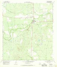
1968 Map of Tilden
USGS Topo · Published 1970About this map
Tilden serves as the focal point of this late 1960s survey, situated at the confluence of several major drainage systems including the Frio River and Leoncita Creek. The town's local infrastructure is well-defined, showing a Cem, Rodeo Grounds, and a Radio Tower, reflecting its role as a regional hub in McMullen County. The landscape to the south is dominated by the prominent Kings Hills, while the river bottomlands are characterized by complex drainage patterns such as Birds Nest Slough and Big Slough.
Find a feature on this map
29 named features on this map. Tap any name to fly to it.
Don’t see what you’re looking for? This feature index may not catch every label — zoom into the map to look around manually.
Map Details
Editions of this 1968 Tilden Map
This is the sole edition of this map. No revisions or reprints were ever made.
Other maps of this area

1920 · Mikeska
USGS Topo · 1:125,000

1925 · Tilden No. 1
USGS Topo · 1:48,000

1925 · Crowther No. 3
USGS Topo · 1:48,000

1925 · Simmons No. 2
USGS Topo · 1:48,000

1929 · Simmons
USGS Topo · 1:62,500

1930 · Tilden
USGS Topo · 1:62,500

1930 · Whitsett
USGS Topo · 1:62,500

1942 · Tilden
USGS Topo · 1:62,500

1942 · Whitsett
USGS Topo · 1:62,500

1953 · Crystal City
USGS Topo · 1:250,000