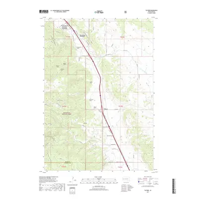
2017 Map of Tilford
USGS Topo · Published 2017About this map
Black Hills National Cemetery lies at the northern edge of this Black Hills landscape, a region defined by complex terrain and steep drainages. The small settlement of Tilford serves as a central point along the north-south transit corridor, shadowed by Blucksberg Mountain and the high points of Bald Mtn. To the west, the protected lands of the Black Hills National Forest dominate the topography, where numerous narrow valleys including Bulldog Gulch, Forbes Gulch, and Breakneck Gulch channel runoff into Elk Cr and Pleasant Valley Cr. This survey illustrates the modern road network, including Sturgis Rd and Pleasant Valley Rd, as it navigates the boundary between Meade Co and Lawrence County. The map provides a detailed look at the interface between private residential development and public forest lands in the late 2010s.
Find a feature on this map
58 named features on this map. Tap any name to fly to it.
Don’t see what you’re looking for? This feature index may not catch every label — zoom into the map to look around manually.
Map Details
Editions of this 2017 Tilford Map
This is the sole edition of this map. No revisions or reprints were ever made.
Other maps of this area

1893 · Rapid
USGS Topo · 1:125,000

1894 · Deadwood
USGS Topo · 1:125,000

1898 · Rapid
USGS Topo · 1:125,000

1899 · Sturgis
USGS Topo · 1:62,500

1901 · Deadwood
USGS Topo · 1:125,000

1903 · Rapid
USGS Topo · 1:125,000

1915 · Sturgis
USGS Topo · 1:62,500

1916 · Deadwood
USGS Topo · 1:125,000

1953 · Blackhawk
USGS Topo · 1:24,000

1953 · Piedmont
USGS Topo · 1:24,000