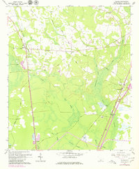
1962 Map of Tillman
USGS Topo · Published 1980About this map
Tillman and Switzerland anchor this corner of the South Carolina Lowcountry, where the landscape is defined by an intricate network of wetlands and historic transport corridors. The Southern and Seaboard Coast Line railroads cut through the terrain, flanking vast expanses like the Hectic Savannas and Great Swamp. Local life is recorded through numerous rural landmarks, including St Matthews Ch, St Johns Ch, and the Arm Oak Ch and Arm Oak Cem. The presence of the Switzerland Canal and several sand and borrow pits suggests a landscape shaped by both natural drainage and local industry. Genealogists may find value in the varied family-named burial grounds such as Floyd Cem and Mew Cem, or the small settlement at Deerfield. The map reveals a transition from traditional river-and-rail connectivity toward modern infrastructure, with the Old Charleston Road and Old Railroad Grade marking earlier eras of movement.
Find a feature on this map
39 named features on this map. Tap any name to fly to it.
Don’t see what you’re looking for? This feature index may not catch every label — zoom into the map to look around manually.
Map Details
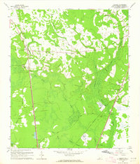
Editions of this 1962 Tillman Map
2 editions found
Other maps of this area

1918 · Yemassee
USGS Topo · 1:62,500

1919 · Pineland
USGS Topo · 1:62,500

1920 · Hardeeville
USGS Topo · 1:62,500

1920 · Okatie
USGS Topo · 1:62,500

1942 · Okatie
USGS Topo · 1:62,500

1943 · Pineland
USGS Topo · 1:62,500

1943 · Hardeeville
USGS Topo · 1:62,500

1943 · Yemassee
USGS Topo · 1:62,500

1947 · Savannah
USGS Topo · 1:250,000

1948 · Savannah
USGS Topo · 1:250,000