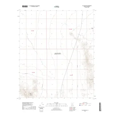
2018 Map of Tillotson Peak
USGS Topo · Published 2018About this map
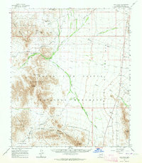
Organ Pipe Cactus National Monument dominates this desert landscape in southern Arizona, where the arid terrain is defined by dramatic peaks and seasonal drainages. Rising from the western edge of the Valley of the Ajo, prominent summits such as Tillotson Peak and Pinkley Peak provide significant navigational landmarks for the region. The map tracks the drainage patterns of Alamo Wash and Cherioni Wash, which carve through the basin floor between the rugged outcrops of Puerto Blanco Mountain. Human passage through this protected wilderness is limited to established corridors like Puerto Blanco Dr and the Co Road Trail, illustrating the balance between conservation and access in this borderlands environment. The cartography reflects a modern view of the Sonoran Desert's natural topography, emphasizing the isolation and elevation changes of the Puerto Blanco range.
Find a feature on this map
13 named features on this map. Tap any name to fly to it.
Don’t see what you’re looking for? This feature index may not catch every label — zoom into the map to look around manually.
Map Details
Editions of this 2018 Tillotson Peak Map
This is the sole edition of this map. No revisions or reprints were ever made.
Other maps of this area

1953 · Ajo
USGS Topo · 1:250,000
1954 · Sonoyta
USGS Topo · 1:250,000

1957 · Ajo
USGS Topo · 1:250,000

1958 · Ajo
USGS Topo · 1:250,000

1962 · Ajo
USGS Topo · 1:250,000

1963 · Ajo
USGS Topo · 1:250,000
1963 · Mt. Ajo
USGS Topo · 1:62,500
1963 · Lukeville
USGS Topo · 1:62,500
1963 · Kino Peak
USGS Topo · 1:62,500
1963 · Lukeville
USGS Topo · 1:250,000