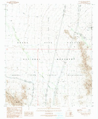
1990 Map of Tillotson Peak
USGS Topo · Published 1990About this map
Valley of the Ajo dominates this high-desert landscape, framed by the stark elevations of the Puerto Blanco Mountains and the distinctive Tillotson Peak. This 1990 provisional survey records the intersection of conservation and resource extraction within the Organ Pipe Cactus National Monument. While much of the terrain is dedicated to the Organ Pipe Cactus Wilderness, the northeastern corner reveals a pocket of industrial history near the Copper Mtn Mine. Here, a concentration of prospects, an adit, and a water tank suggest a localized era of mineral exploration. Transport through this arid environment is limited, primarily defined by the Puerto Blanco Drive and the ephemeral drainage patterns of Alamo Wash and Cherioni Wash, which dictate the natural movement across the basin floor.
Find a feature on this map
16 named features on this map. Tap any name to fly to it.
Don’t see what you’re looking for? This feature index may not catch every label — zoom into the map to look around manually.
Map Details
Editions of this 1990 Tillotson Peak Map
This is the sole edition of this map. No revisions or reprints were ever made.
Other maps of this area

1953 · Ajo
USGS Topo · 1:250,000

1954 · Sonoyta
USGS Topo · 1:250,000

1957 · Ajo
USGS Topo · 1:250,000

1958 · Ajo
USGS Topo · 1:250,000

1962 · Ajo
USGS Topo · 1:250,000

1963 · Ajo
USGS Topo · 1:250,000

1963 · Mt. Ajo
USGS Topo · 1:62,500

1963 · Lukeville
USGS Topo · 1:62,500

1963 · Kino Peak
USGS Topo · 1:62,500

1963 · Lukeville
USGS Topo · 1:250,000