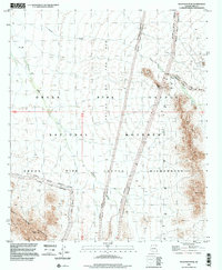
1996 Map of Tillotson Peak
USGS Topo · Published 2000About this map
The Valley of the Ajo dominates this high-desert landscape as it appeared in the late 1990s, flanked by the prominent heights of Tillotson Peak and the Puerto Blanco Mountains. This survey documents a critical portion of the Organ Pipe Cactus National Monument, where the environment is defined by expansive drainage systems like Alamo Wash and Cherioni Wash. Human activity is concentrated along the Puerto Blanco Drive and Alamo Canyon Rd, while the eastern portion of the quadrangle is largely protected under the Organ Pipe Cactus Wilderness designation. Traces of early prospectors are found near Eagle Pass, where scattered sites including an Adit and various prospect pits indicate the history of mineral exploration in these arid peaks. Notable summits like Pinkley Peak provide topographic anchors for a region defined by its conservation status and rugged isolation.
Find a feature on this map
22 named features on this map. Tap any name to fly to it.
Don’t see what you’re looking for? This feature index may not catch every label — zoom into the map to look around manually.
Map Details
Editions of this 1996 Tillotson Peak Map
This is the sole edition of this map. No revisions or reprints were ever made.
Other maps of this area

1953 · Ajo
USGS Topo · 1:250,000

1954 · Sonoyta
USGS Topo · 1:250,000

1957 · Ajo
USGS Topo · 1:250,000

1958 · Ajo
USGS Topo · 1:250,000

1962 · Ajo
USGS Topo · 1:250,000

1963 · Ajo
USGS Topo · 1:250,000

1963 · Mt. Ajo
USGS Topo · 1:62,500

1963 · Lukeville
USGS Topo · 1:62,500

1963 · Kino Peak
USGS Topo · 1:62,500

1963 · Lukeville
USGS Topo · 1:250,000