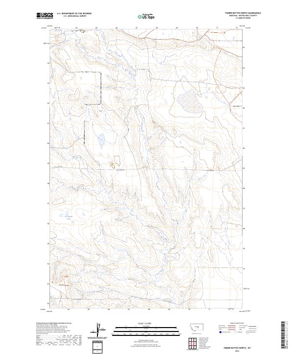
2024 Map of Timber Buttes North
USGS Topo · Published 2024About this map
Pole Creek meanders through this section of Musselshell County, defining the drainage patterns of a landscape marked by elevation shifts and isolated water bodies. The terrain is characterized by the Timber Buttes in the southwest, rising above the surrounding plains. To the north, the Des Moines Lakes provide a distinct hydrological cluster in an otherwise arid expanse. The transportation network is sparse, consisting primarily of utility-focused routes like Pole Creek Rd and Golf Course Rd, which suggest a transition from grazing lands to localized development. This modern survey, based on imagery from 2017 and 2018, documents the township and range boundaries of T10N and T9N as they intersect the R23E and R24E lines, offering a clear view of the enduring rural structure of this Montana interior.
Find a feature on this map
9 named features on this map. Tap any name to fly to it.
Don’t see what you’re looking for? This feature index may not catch every label — zoom into the map to look around manually.
Map Details
Editions of this 2024 Timber Buttes North Map
This is the sole edition of this map. No revisions or reprints were ever made.
Other maps of this area

1954 · Roundup
USGS Topo · 1:250,000

1958 · Roundup
USGS Topo · 1:250,000

1979 · Roundup
USGS Topo · 1:100,000

1979 · Lavina NW
USGS Topo · 1:24,000

1979 · Timber Buttes South
USGS Topo · 1:24,000

1979 · Horsethief Creek
USGS Topo · 1:24,000

1986 · Devils Hole Lake
USGS Topo · 1:24,000

1986 · Pender Coulee
USGS Topo · 1:24,000

1986 · Lake Mason NW
USGS Topo · 1:24,000

1986 · Emory School
USGS Topo · 1:24,000