
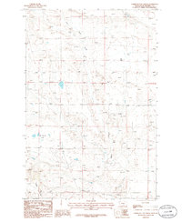
1979 Map of Lavina NW
USGS Topo · Published 1979About this map
Currant Creek and Smith Creek meander through this central Montana landscape, which is defined by a series of deep drainage channels including Twin Coulee and Cameron Coulee. In the late 1970s, the terrain shows a sparse ranching and utility footprint, with a long Pipeline cutting across the northern sections and small-scale excavations like the Gravel Pit near the creek beds. The boundary between Golden Valley and Musselshell Counties runs through the eastern portion of the map, while the high point at Harmon stands out as a notable landmark in an area largely characterized by vast, open grazing land. This survey captures the subtle infrastructure of rural Montana, from isolated wells to the network of unimproved roads that trace the natural contours of the coulees.
Find a feature on this map
9 named features on this map. Tap any name to fly to it.
Don’t see what you’re looking for? This feature index may not catch every label — zoom into the map to look around manually.
Map Details
Editions of this 1979 Lavina NW Map
This is the sole edition of this map. No revisions or reprints were ever made.
Other maps of this area

1889 · Big Snowy Mountain
USGS Topo · 1:250,000

1893 · Big Snowy Mountain
USGS Topo · 1:250,000

1954 · Roundup
USGS Topo · 1:250,000

1958 · Roundup
USGS Topo · 1:250,000

1979 · Roundup
USGS Topo · 1:100,000

1979 · Bundy
USGS Topo · 1:24,000

1979 · Timber Buttes South
USGS Topo · 1:24,000

1979 · Lavina
USGS Topo · 1:24,000

1986 · Emory School
USGS Topo · 1:24,000
1986 · Timber Buttes North
USGS Topo · 1:24,000