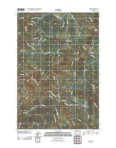
2011 Map of Timber
USGS Topo · Published 2011About this map
Timber and Glenwood anchor this 2011 survey of northwestern Washington County, where the steep terrain of the Northern Oregon Coast Range dictates the flow of commerce and water. The map documents the presence of both the Timber Post Office and the Glenwood Post Office, essential nodes for these small rural communities. The landscape is defined by the winding Nehalem River in the north and the upper reaches of Gales Creek to the south, with significant landmarks such as Sunset Tunnel and Walcott Tunnel marking the passage of transportation routes through the ridges. The area's focus on youth and community is noted at the Gales Creek Childrens Camp, while the surrounding forest is crisscrossed by an extensive network of timber-related roads like NW Timber Rd and NW Cochran Rd, reflecting the region's enduring connection to the logging industry and its rugged geography near Round Top.
Find a feature on this map
50 named features on this map. Tap any name to fly to it.
Don’t see what you’re looking for? This feature index may not catch every label — zoom into the map to look around manually.
Map Details
Editions of this 2011 Timber Map
This is the sole edition of this map. No revisions or reprints were ever made.
Other maps of this area

1940 · Vernonia
USGS Topo · 1:62,500

1941 · Keasey
USGS Topo · 1:62,500

1941 · Timber
USGS Topo · 1:62,500

1941 · Gales Creek
USGS Topo · 1:62,500

1943 · Vernonia
USGS Topo · 1:62,500

1943 · Keasey
USGS Topo · 1:62,500

1948 · Vancouver
USGS Topo · 1:250,000

1950 · Vancouver
USGS Topo · 1:250,000

1950 · Vancouver
USGS Topo · 1:250,000

1955 · Timber
USGS Topo · 1:62,500