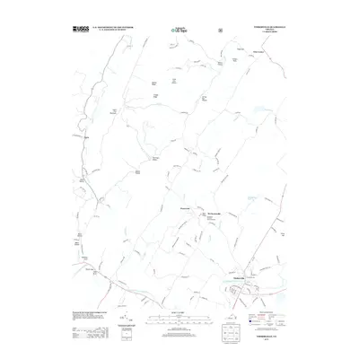
2013 Map of Timberville
USGS Topo · Published 2013About this map
Timberville sits as a primary hub along the N Fork Shenandoah River in this 2013 survey of Rockingham County. The landscape is defined by its deep agricultural and topographical character, featuring the prominent Showalters Orchard and Greenhouse nestled near Baer Ridge. Smaller clusters of settlement such as Honeyville, Mechanicsville, and Getz Corner are connected by a network of local roads including Mechanicsville Rd and Raders Church Rd.
Find a feature on this map
117 named features on this map. Tap any name to fly to it.
Don’t see what you’re looking for? This feature index may not catch every label — zoom into the map to look around manually.
Map Details
Editions of this 2013 Timberville Map
This is the sole edition of this map. No revisions or reprints were ever made.
Other maps of this area

1892 · Woodstock
USGS Topo · 1:125,000

1921 · Orkney Springs
USGS Topo · 1:48,000

1923 · Orkney Springs
USGS Topo · 1:62,500

1923 · Edinburg
USGS Topo · 1:62,500

1940 · Orkney Springs
USGS Topo · 1:48,000

1942 · Mt Jackson
USGS Topo · 1:62,500

1943 · Orkney Springs
USGS Topo · 1:62,500

1944 · Orkney Springs
USGS Topo · 1:62,500

1946 · Mt Jackson
USGS Topo · 1:62,500

1947 · Mt Jackson
USGS Topo · 1:62,500