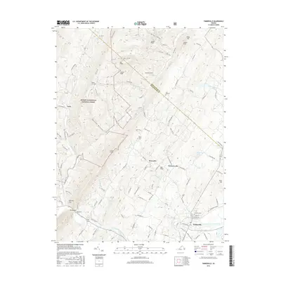
2016 Map of Timberville
USGS Topo · Published 2016About this map
The North Fork Shenandoah River flows through the southeastern corner of this terrain, anchoring the town of Timberville. This area is defined by the sharp contrast between the dense ridges of the George Washington National Forest and the agricultural valley floor. Small historic clusters like Honeyville and Mechanicsville sit along the winding roads east of Little N Mtn. The landscape is etched with steep hollows including Cook Lick Hollow and Hottinger Hollow, while local genealogy is rooted in sites like Timberville Cem and Rader Cem. Distinctive geological formations such as Chimney Rock and Gap Rock at Brocks Gap mark the transition where the river cuts through the mountains. This 2016 survey illustrates the persistent rural character of the Shenandoah and Rockingham county line.
Find a feature on this map
107 named features on this map. Tap any name to fly to it.
Don’t see what you’re looking for? This feature index may not catch every label — zoom into the map to look around manually.
Map Details
Editions of this 2016 Timberville Map
This is the sole edition of this map. No revisions or reprints were ever made.
Other maps of this area

1892 · Woodstock
USGS Topo · 1:125,000

1921 · Orkney Springs
USGS Topo · 1:48,000

1923 · Orkney Springs
USGS Topo · 1:62,500

1923 · Edinburg
USGS Topo · 1:62,500

1940 · Orkney Springs
USGS Topo · 1:48,000

1942 · Mt Jackson
USGS Topo · 1:62,500

1943 · Orkney Springs
USGS Topo · 1:62,500

1944 · Orkney Springs
USGS Topo · 1:62,500

1946 · Mt Jackson
USGS Topo · 1:62,500

1947 · Mt Jackson
USGS Topo · 1:62,500