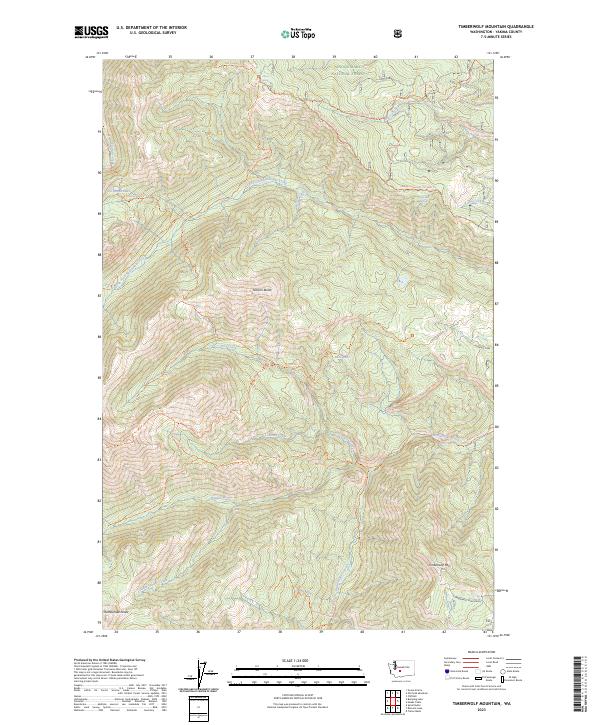
2023 Map of Timberwolf Mountain
USGS Topo · Published 2023About this map
Timberwolf Mtn and Nelson Butte define the high country of this portion of the Snoqualmie National Forest. The landscape is a network of ridges and drainage basins, most notably the North Fork Rattlesnake Creek and Hindoo Creek. This area includes the protected William O Douglas Wilderness, characterized by a system of historical packing and hiking routes such as the Richmond Mine Trl and Dog Creek Trl. Evidence of earlier resource extraction is marked by the Richmond Mine located near Richmond Lake. The map reveals a high-altitude environment dotted with water sources like Schneider Springs and Clover Spring, essential for the high-country travel reflected in the numerous 4WD trails and ridge-line routes that traverse the complex topography.
Find a feature on this map
48 named features on this map. Tap any name to fly to it.
Don’t see what you’re looking for? This feature index may not catch every label — zoom into the map to look around manually.
Map Details
Editions of this 2023 Timberwolf Mountain Map
This is the sole edition of this map. No revisions or reprints were ever made.
Other maps of this area

1902 · Mount Aix
USGS Topo · 1:125,000

1904 · Mt Aix
USGS Topo · 1:125,000

1950 · Yakima
USGS Topo · 1:250,000

1958 · Yakima
USGS Topo · 1:250,000

1961 · Yakima
USGS Topo · 1:250,000

1962 · Bumping Lake
USGS Topo · 1:62,500

1962 · White Pass
USGS Topo · 1:62,500

1967 · Rimrock Lake
USGS Topo · 1:24,000

1967 · Tieton Basin
USGS Topo · 1:24,000
1971 · Cliffdell
USGS Topo · 1:24,000