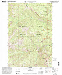
2000 Map of Timberwolf Mountain
USGS Topo · Published 2001About this map
William O Douglas Wilderness dominates this mountainous landscape in Yakima County, where high peaks and remote creek drainages define the topography. The terrain is characterized by significant elevations including Timberwolf Mtn and Nelson Butte, while the Mt Baker Snoqualmie National Forest manages the land use. The water system is particularly complex, featuring the North Fork Rattlesnake Creek and Hindoo Creek, alongside smaller bodies like Richmond Lake and Buck Lake.
Find a feature on this map
28 named features on this map. Tap any name to fly to it.
Don’t see what you’re looking for? This feature index may not catch every label — zoom into the map to look around manually.
Map Details
Editions of this 2000 Timberwolf Mountain Map
This is the sole edition of this map. No revisions or reprints were ever made.
Other maps of this area

1902 · Mount Aix
USGS Topo · 1:125,000

1904 · Mt Aix
USGS Topo · 1:125,000

1950 · Yakima
USGS Topo · 1:250,000

1958 · Yakima
USGS Topo · 1:250,000

1961 · Yakima
USGS Topo · 1:250,000

1962 · Bumping Lake
USGS Topo · 1:62,500

1962 · White Pass
USGS Topo · 1:62,500

1967 · Rimrock Lake
USGS Topo · 1:24,000

1967 · Tieton Basin
USGS Topo · 1:24,000
1971 · Cliffdell
USGS Topo · 1:24,000