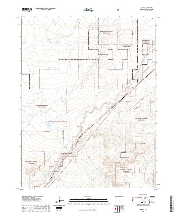
2022 Map of Timpas
USGS Topo · Published 2022About this map
Comanche National Grassland dominates this portion of the high plains in Otero County, where the landscape is etched by seasonal watercourses and historic transit corridors. The Santa Fe National Historic Trl cuts diagonally across the terrain, following the general path of the railroad and connecting the small settlements of Timpas and Ayer. These outposts represent the sparse human footprint in an area characterized by wide-reaching drainage systems like Timpas Cr, Lone Tree Arroyo, and Hog Ranch Arroyo. The presence of the Timpas Cem near the main townsite provides a focused point for genealogical research, while the Brown Reservoir indicates the critical importance of water management for ranching and survival in this arid environment. The map effectively captures the intersection of early pioneer pathways and modern conservation lands.
Find a feature on this map
20 named features on this map. Tap any name to fly to it.
Don’t see what you’re looking for? This feature index may not catch every label — zoom into the map to look around manually.
Map Details
Editions of this 2022 Timpas Map
This is the sole edition of this map. No revisions or reprints were ever made.
Other maps of this area

1891 · Timpas
USGS Topo · 1:125,000

1894 · Timpas
USGS Topo · 1:125,000

1955 · La Junta
USGS Topo · 1:250,000

1958 · La Junta
USGS Topo · 1:250,000

1965 · La Junta SW
USGS Topo · 1:24,000
1966 · Hawley
USGS Topo · 1:24,000

1968 · La Junta
USGS Topo · 1:250,000
1972 · Timpas NE
USGS Topo · 1:24,000

1972 · Packers Gap
USGS Topo · 1:24,000
1972 · Timpas SW
USGS Topo · 1:24,000