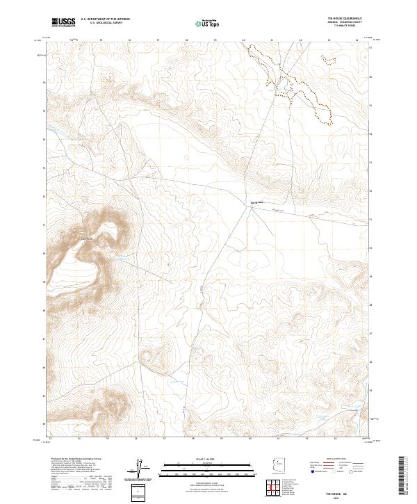
2021 Map of Tin House
USGS Topo · Published 2021About this map
Tin House sits at a lonely intersection on the Coconino plateau, serving as a rare landmark in a landscape defined by water management and drainage patterns. The topography is dominated by the high ground of Long Point, while the surrounding terrain is etched by the Farm Dam Draw and Monument Wash. This arid environment necessitated a network of catchment systems, visible through numerous named water features including Cajon Tank, Little Baldy Tank, and Banks Tank, which reflect the ranching heritage and resource management of northern Arizona.
Find a feature on this map
15 named features on this map. Tap any name to fly to it.
Don’t see what you’re looking for? This feature index may not catch every label — zoom into the map to look around manually.
Map Details
Editions of this 2021 Tin House Map
This is the sole edition of this map. No revisions or reprints were ever made.
Other maps of this area

1886 · Chino
USGS Topo · 1:250,000

1891 · Chino
USGS Topo · 1:250,000

1948 · Williams
USGS Topo · 1:250,000

1954 · Williams
USGS Topo · 1:250,000

1956 · Williams
USGS Topo · 1:250,000

1960 · Williams
USGS Topo · 1:250,000

1961 · Williams
USGS Topo · 1:250,000

1979 · Little Harpo Canyon
USGS Topo · 1:24,000

1980 · Hazen Hole Tank
USGS Topo · 1:24,000
1980 · Markham Dam
USGS Topo · 1:24,000