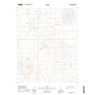
2020 Map of Tinaja Mountain
USGS Topo · Published 2020About this map
Tinaja Mtn and its surrounding high-desert plateaus dominate this landscape in Colfax County. The terrain is defined by massive landforms like Dwyer Mesa and Blosser Mesa, which rise above the drainages of Eagle Tail Cr and the W Fork Tinaja Cr. The presence of Cottonwood Spring suggests a critical water source in this arid environment, a vital point for ranching and wildlife near the base of the ridges. Transportation across this high country is limited to specialized ranch roads like the McAuliffe Ranch Prd and the To Ranch Prd, reflecting the area's ongoing use for large-scale livestock operations. Other prominent elevations such as Green Mtn, Tinaja Mesa, and Red Mtn provide a topographic profile characteristic of the northern New Mexico plains.
Find a feature on this map
19 named features on this map. Tap any name to fly to it.
Don’t see what you’re looking for? This feature index may not catch every label — zoom into the map to look around manually.
Map Details
Editions of this 2020 Tinaja Mountain Map
This is the sole edition of this map. No revisions or reprints were ever made.
Other maps of this area
1912 · Raton
USGS Topo · 1:62,500
1914 · Raton
USGS Topo · 1:62,500
1954 · Raton
USGS Topo · 1:250,000
1958 · Raton
USGS Topo · 1:250,000
1971 · Clifton House
USGS Topo · 1:24,000
1971 · Tres Hermanos Peak
USGS Topo · 1:24,000
1971 · Eagle Tail Mountain
USGS Topo · 1:24,000
1971 · Loco Arroyo
USGS Topo · 1:24,000
1971 · Hunter Mesa
USGS Topo · 1:24,000
1971 · Johnson Park
USGS Topo · 1:24,000