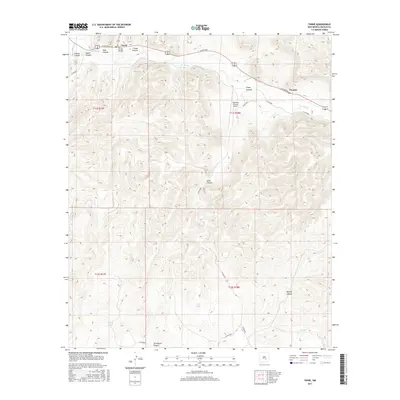
2017 Map of Tinnie
USGS Topo · Published 2017About this map
Rio Hondo cuts a winding path through this portion of Lincoln County, defining the settlement patterns of Tinnie and Picacho. These communities are tied to the river valley, where the Rio Hondo Bridge facilitates movement across the waterway. The surrounding terrain is a complex network of drainage systems, including Tinnie Canyon, Goat Canyon, and Alamo Canyon, which feed into the main valley from the high ground.
Find a feature on this map
27 named features on this map. Tap any name to fly to it.
Don’t see what you’re looking for? This feature index may not catch every label — zoom into the map to look around manually.
Map Details
Editions of this 2017 Tinnie Map
This is the sole edition of this map. No revisions or reprints were ever made.
Other maps of this area

1955 · Roswell
USGS Topo · 1:250,000

1958 · Roswell
USGS Topo · 1:250,000

1961 · Flying H
USGS Topo · 1:62,500

1961 · Lincoln
USGS Topo · 1:62,500

1961 · Tinnie
USGS Topo · 1:62,500

1962 · Roswell
USGS Topo · 1:250,000

1963 · Deadman Lake
USGS Topo · 1:24,000

1984 · Ruidoso
USGS Topo · 1:100,000
1988 · Nelson Canyon East
USGS Topo · 1:24,000
1988 · Sunset
USGS Topo · 1:24,000