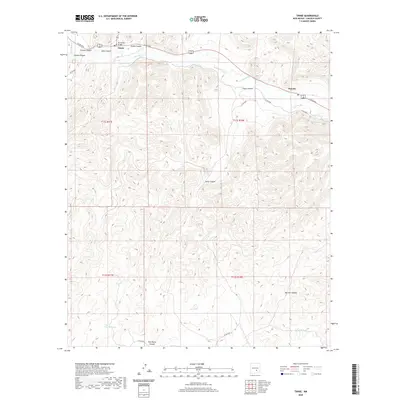
2020 Map of Tinnie
USGS Topo · Published 2020About this map
The Rio Hondo valley serves as the primary artery of human activity in this Lincoln County region, where the settlements of Tinnie and Picacho are established along its course. The Rio Hondo Bridge carries traffic across the water, anchoring the small community at Tinnie near the confluence of several drainages, including Tinnie Canyon and Goat Canyon. The surrounding terrain is a complex network of deep draws and high points, illustrated by the many canyons like Alamo Canyon and Twin Butte Canyon that feed toward the river valley.
Find a feature on this map
27 named features on this map. Tap any name to fly to it.
Don’t see what you’re looking for? This feature index may not catch every label — zoom into the map to look around manually.
Map Details
Editions of this 2020 Tinnie Map
This is the sole edition of this map. No revisions or reprints were ever made.
Other maps of this area

1955 · Roswell
USGS Topo · 1:250,000

1958 · Roswell
USGS Topo · 1:250,000

1961 · Flying H
USGS Topo · 1:62,500

1961 · Lincoln
USGS Topo · 1:62,500

1961 · Tinnie
USGS Topo · 1:62,500

1962 · Roswell
USGS Topo · 1:250,000

1963 · Deadman Lake
USGS Topo · 1:24,000

1984 · Ruidoso
USGS Topo · 1:100,000
1988 · Nelson Canyon East
USGS Topo · 1:24,000
1988 · Sunset
USGS Topo · 1:24,000