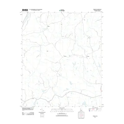
2012 Map of Tinsley
USGS Topo · Published 2012About this map
The Tinsley Oil Field dominates this central Mississippi landscape, marking a site of significant industrial importance within Yazoo County. This early 21st-century survey details the infrastructure supporting the local petroleum industry, including the settlement of Oil City and the nearby village of Tinsley, which features its own Post Office. The terrain is defined by a dense network of drainage systems, including Thompson Creek, Perry Creek, and Mound Creek, which carve through the land alongside numerous family-named routes such as Robinette Road and Edgar Garrison Road. Genealogists and local historians will find value in the placement of several small burial sites, including Cessna Cemetery, Hudson Cemetery, and Ogden Cemetery. The presence of Anding to the east further illustrates the rural settlement pattern, where small communities emerged around transport lines and natural resource extraction points.
Find a feature on this map
66 named features on this map. Tap any name to fly to it.
Don’t see what you’re looking for? This feature index may not catch every label — zoom into the map to look around manually.
Map Details
Editions of this 2012 Tinsley Map
This is the sole edition of this map. No revisions or reprints were ever made.
Other maps of this area

1940 · Mechanicsburg
USGS Topo · 1:62,500

1955 · Jackson
USGS Topo · 1:250,000

1961 · Jackson
USGS Topo · 1:250,000

1961 · Bayland
USGS Topo · 1:62,500

1961 · Valley
USGS Topo · 1:62,500

1962 · Jackson
USGS Topo · 1:250,000

1962 · Flora
USGS Topo · 1:62,500

1963 · Mechanicsburg
USGS Topo · 1:62,500

1984 · Yazoo City
USGS Topo · 1:100,000
1988 · Benton
USGS Topo · 1:24,000