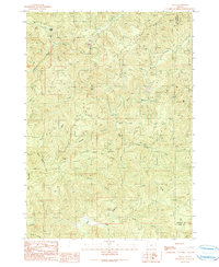
1990 Map of Tioga
USGS Topo · Published 1990About this map
Tioga and the surrounding timberlands of the Oregon Coast Range are defined by a complex drainage network at the border of Coos and Douglas counties. This 1990 provisional map documents the industrial and natural landscape, centered on the South Fork Coos River and the North Fork Coquille River. The terrain is marked by prominent elevations such as Coos Mountain and the expansive High Ridge, with several extractive sites indicated by Quarry labels throughout the hills. Small outposts like Farrin Camp and Williams appear alongside the intricate system of logging roads and 4WD tracks that thread through the steep valleys. Water management and resource tracking are evidenced by the Gaging Station and a Water Tank near Hatcher Creek. This survey provides a precise look at the working forest landscape, including named drainages like Hog Ranch Creek and Shotgun Creek that characterize the region's geography.
Find a feature on this map
28 named features on this map. Tap any name to fly to it.
Don’t see what you’re looking for? This feature index may not catch every label — zoom into the map to look around manually.
Map Details
Editions of this 1990 Tioga Map
This is the sole edition of this map. No revisions or reprints were ever made.
Other maps of this area

1928 · Sitkum
USGS Topo · 1:125,000

1955 · Camas Valley
USGS Topo · 1:62,500

1955 · Ivers Peak
USGS Topo · 1:62,500

1955 · Sitkum
USGS Topo · 1:62,500

1955 · Tyee
USGS Topo · 1:62,500

1958 · Roseburg
USGS Topo · 1:250,000

1959 · Roseburg
USGS Topo · 1:250,000

1979 · Roseburg
USGS Topo · 1:100,000
1990 · Cedar Creek
USGS Topo · 1:24,000
1990 · Golden Falls
USGS Topo · 1:24,000