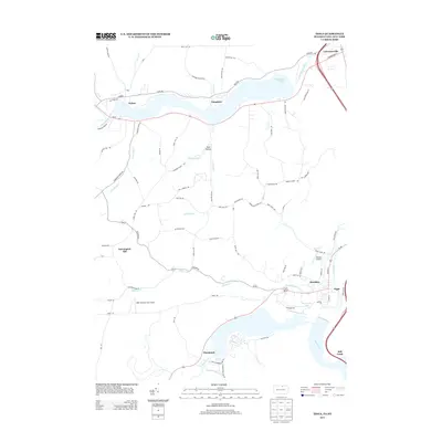
2013 Map of Tioga
USGS Topo · Published 2013About this map
Cowanesque Lake and Hammond Lake dominate this borderland landscape, where the waters of the Cowanesque River and Crooked Creek meet the Tioga River. The 2013 data illustrates a region shaped by modern flood control, specifically the Hammond Dm, which manages the flow near the settlement of Tioga. To the north, the village of Lawrenceville sits at the junction of major transit corridors near the New York state line. The map captures a series of upland hollows and ridges, such as Gee Hollow and Farmington Hill, which are accessed by family-named roads like Croft Hill Rd and Heater Hill Rd. Small aviation sites, including the Nielsen Airport and H&H Personal Use Airport, are scattered among the rural townships, reflecting the contemporary land use of these river valleys.
Find a feature on this map
76 named features on this map. Tap any name to fly to it.
Don’t see what you’re looking for? This feature index may not catch every label — zoom into the map to look around manually.
Map Details
Editions of this 2013 Tioga Map
This is the sole edition of this map. No revisions or reprints were ever made.
Other maps of this area

1900 · Tioga
USGS Topo · 1:62,500

1900 · Elkland
USGS Topo · 1:62,500

1902 · Tioga
USGS Topo · 1:62,500

1914 · Corning
USGS Topo · 1:62,500

1924 · Woodhull
USGS Topo · 1:48,000

1926 · Woodhull
USGS Topo · 1:62,500

1944 · Woodhull
USGS Topo · 1:62,500

1944 · Corning
USGS Topo · 1:62,500

1950 · Elmira
USGS Topo · 1:250,000
1953 · Borden
USGS Topo · 1:24,000