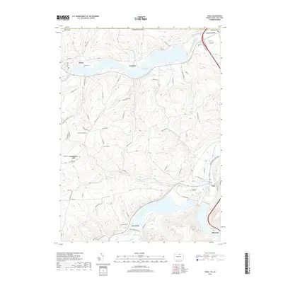
2019 Map of Tioga
USGS Topo · Published 2019About this map
Lawrenceville and Tioga anchor this Pennsylvania borderland, where the Tioga River and Cowanesque River converge near the New York state line. The landscape is dominated by significant water management projects, specifically Cowanesque Lake and Hammond Lake, which have reshaped the valley floor around the small settlements of Tompkins and Hammond. The surrounding hillsides are etched with local history, evidenced by numerous burial grounds such as Lawrenceville Cem, Nelson Cem, and Dailey Cem. Transport infrastructure ranges from quiet rural routes like Heater Hill Rd and Pease Hill Rd to the modern corridor of the Appalachian Throughway. Notable topographic features like Gee Hollow and Ives Run define the drainage patterns of this northern Tioga County terrain, while the settlement at Farmington Hill serves as a high-ground landmark in the southwestern quadrant.
Find a feature on this map
76 named features on this map. Tap any name to fly to it.
Don’t see what you’re looking for? This feature index may not catch every label — zoom into the map to look around manually.
Map Details
Editions of this 2019 Tioga Map
This is the sole edition of this map. No revisions or reprints were ever made.
Other maps of this area

1900 · Tioga
USGS Topo · 1:62,500

1900 · Elkland
USGS Topo · 1:62,500

1902 · Tioga
USGS Topo · 1:62,500

1914 · Corning
USGS Topo · 1:62,500

1924 · Woodhull
USGS Topo · 1:48,000

1926 · Woodhull
USGS Topo · 1:62,500

1944 · Woodhull
USGS Topo · 1:62,500

1944 · Corning
USGS Topo · 1:62,500

1950 · Elmira
USGS Topo · 1:250,000
1953 · Borden
USGS Topo · 1:24,000